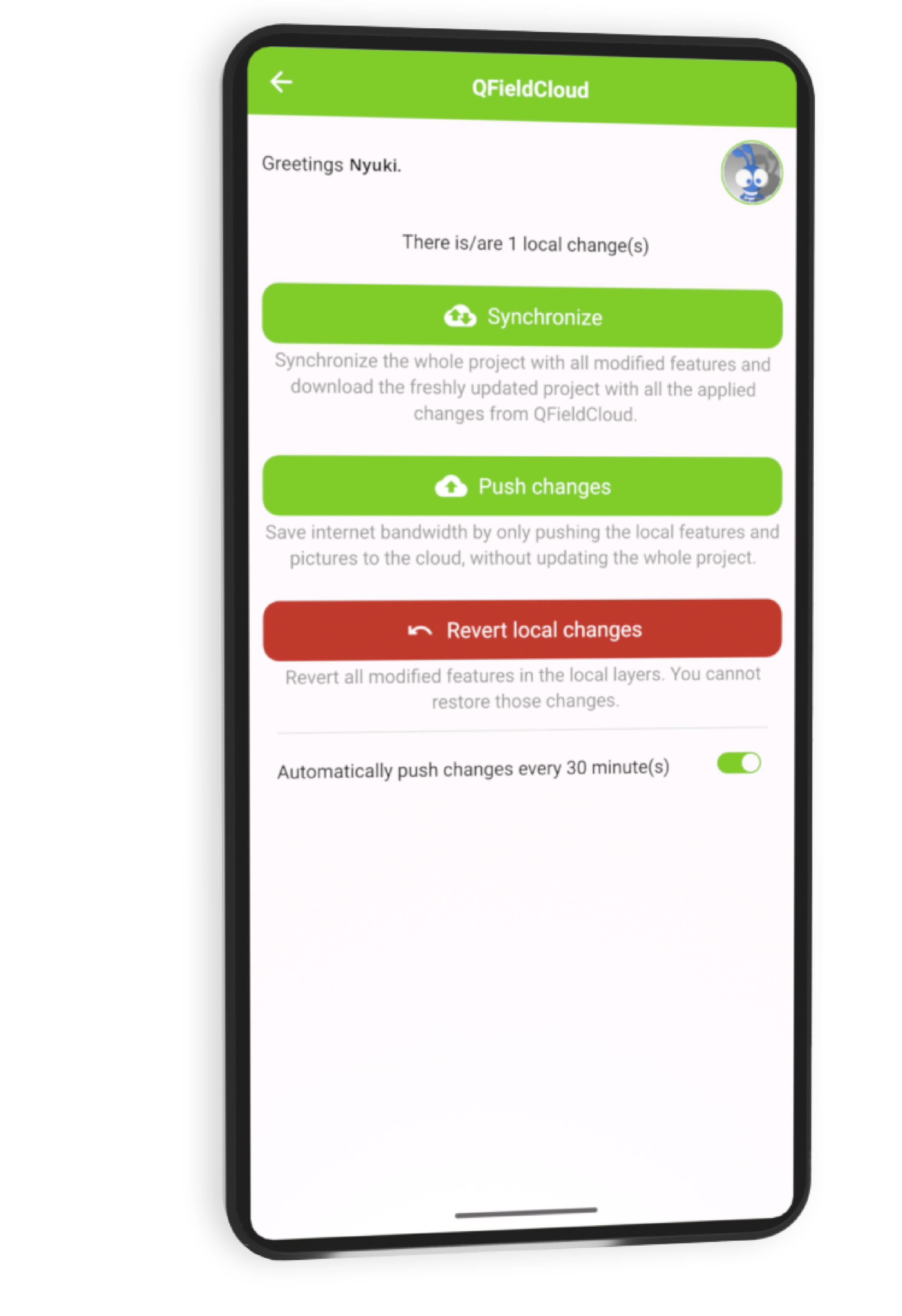
Synchronise
and collaborate.
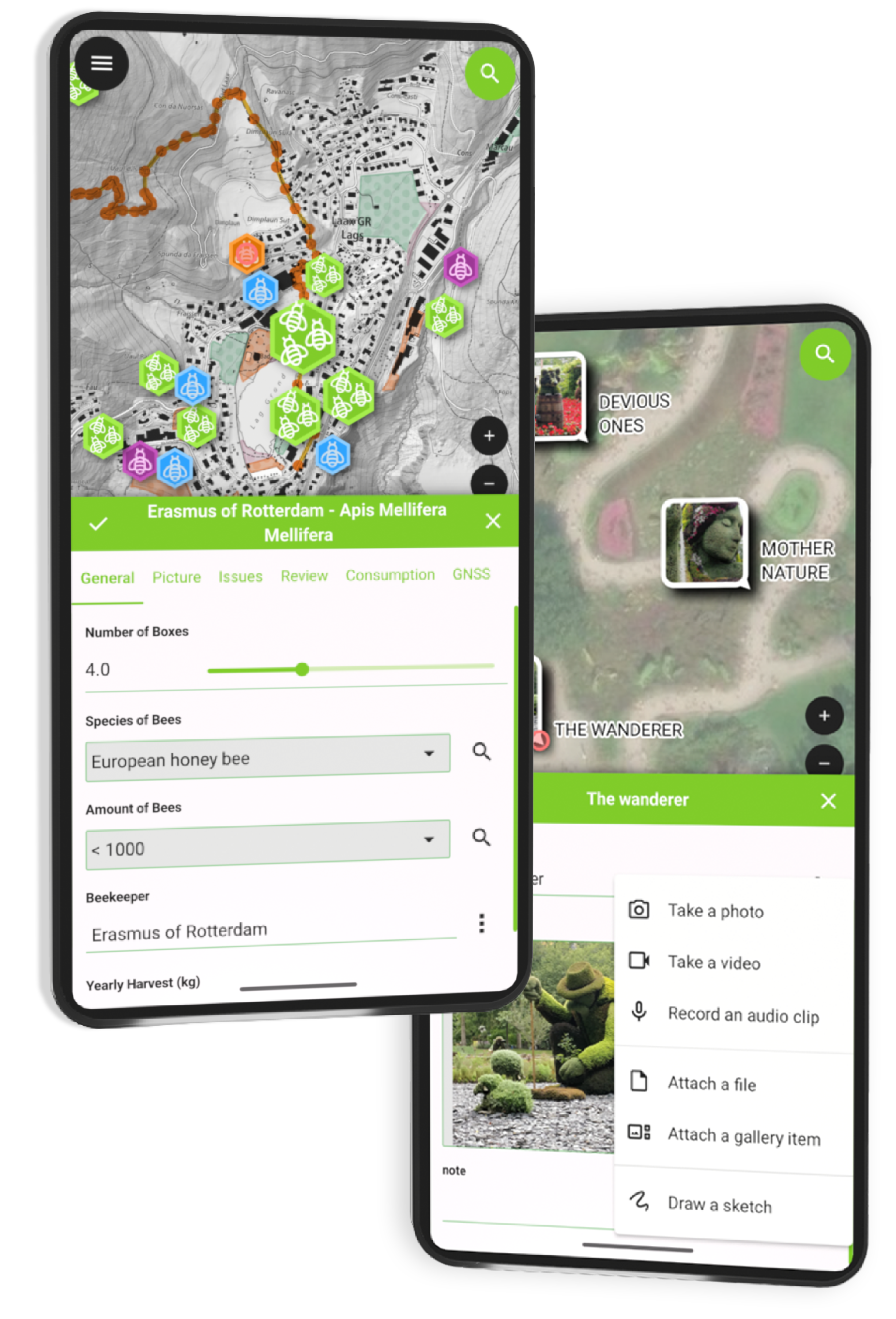
Collect
and edit data.
QFieldCloud allows to synchronize and merge the data collected by your team in QField. From small individual projects to large data collection campaigns, QFieldCloud removes the pain from synchronizing and merging data.

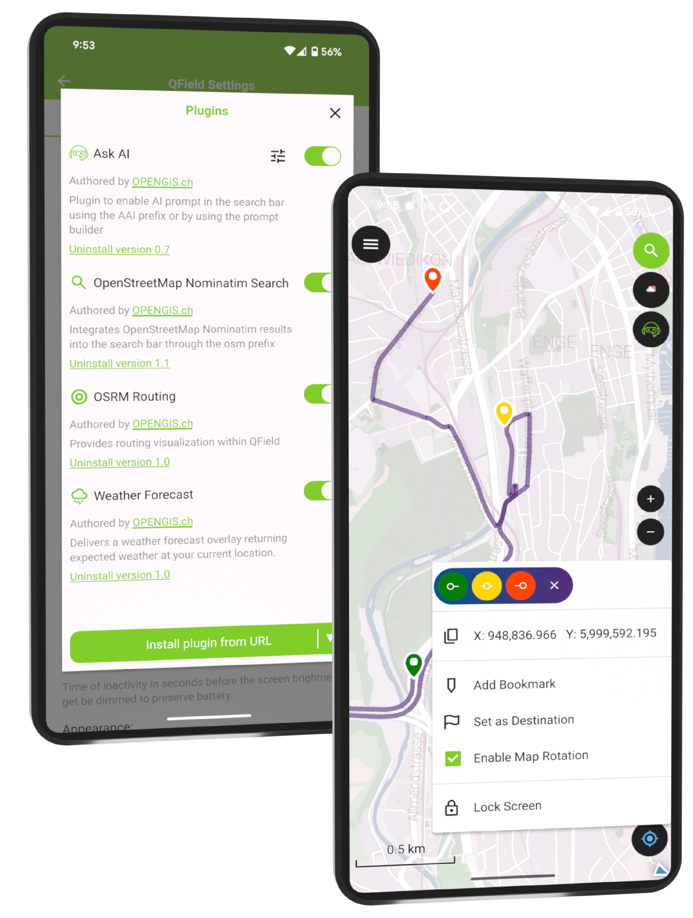
Sync projects and data in real time and work with GeoPackages, KML, GPX, georeferenced PDFs, and more.

Create rich survey forms with constraints, logic, defaults, and validations — all in QGIS.

Working in the wild ? You can continue to work seamlessly with QFieldCloud, and sync back your changes once you're back in town.

QFieldCloud perfectly integrates and extends your QGIS based geodata infrastructure.

Subscribe for a worry-free Swiss-made solution hosted on Swiss datacenters or contact us for your private cloud instance.

QFieldCloud code is open source so you can see what is actually happening to your data.
Let QFieldCoud manage it. Accurately, efficiently, and anywhere it matters. Get started now


The KulturGutRetter project (Cultural Heritage Response Unit)
has successfully completed its
latest field tests, demonstrating the effectiveness of its innovative approach to
the emergency rescue of cultural heritage.
Utilizing cutting-edge data acquisition and management
techniques, Kulturgutretter is leading the way in preserving
invaluable cultural treasures and to safeguard heritage for
future generations.
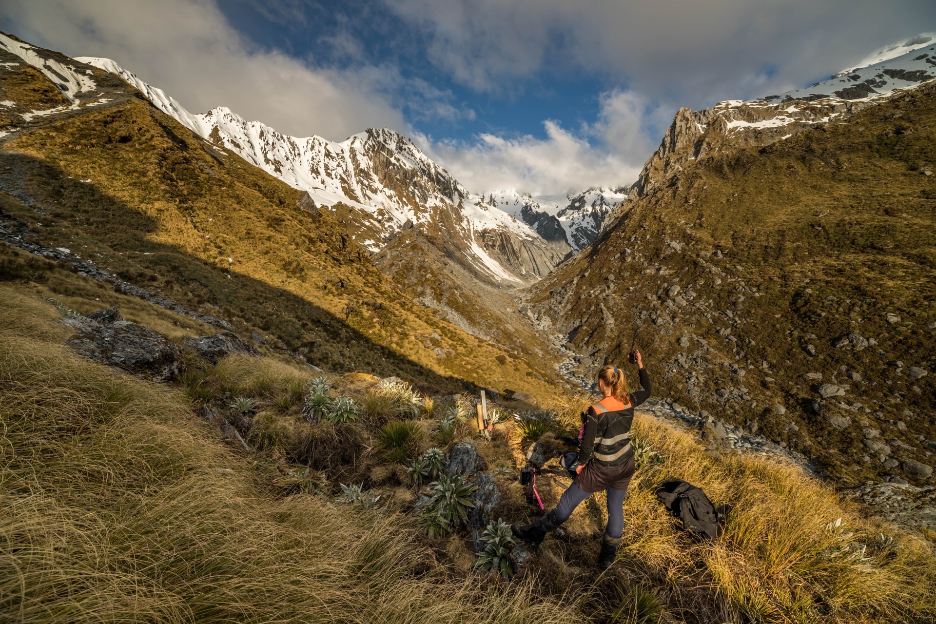
« In the rugged wilderness of New Zealand's South Westland, an ambitious conservation project is underway. Zero Invasive Predators (ZIP) is systematically eliminating possums, rats, and stoats from vast tracts of forest—with QField and QFieldCloud playing a crucial role in their operations. »
Read more...
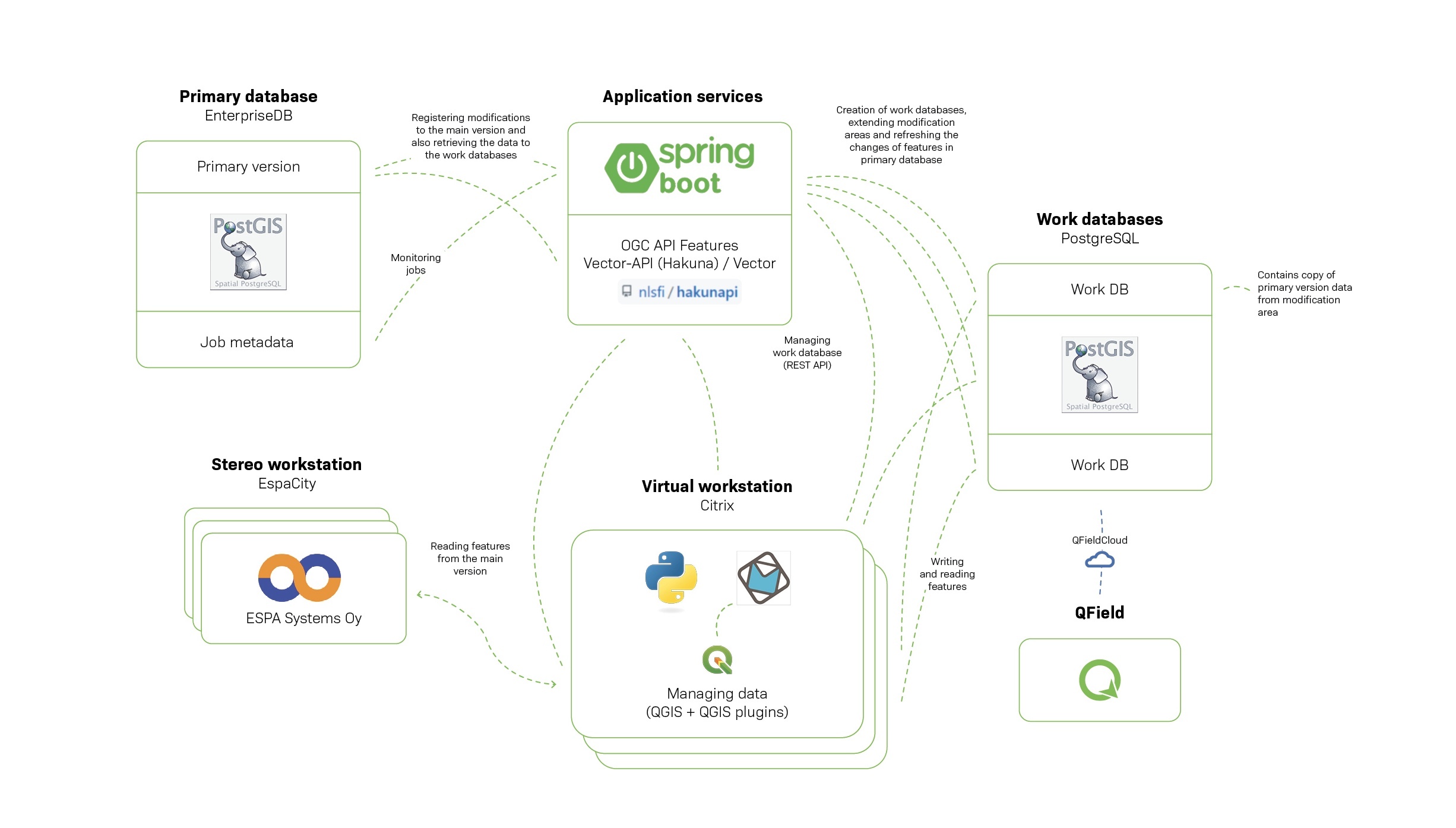
«
The National Land Survey of Finland (NLS) is revolutionizing its
topographic data management system with a new infrastructure
entirely based on open-source components. As part of this
transformation, NLS is integrating QField and QFieldCloud to
meet their specific field mapping requirements. This integration
enables NLS operators to efficiently manage large quantities of
data while working offline in the field. With QField, NLS
ensures precise and reliable data collection in various
environments, enhancing the overall efficiency and accuracy of
their topographic surveys.
»
Read more...
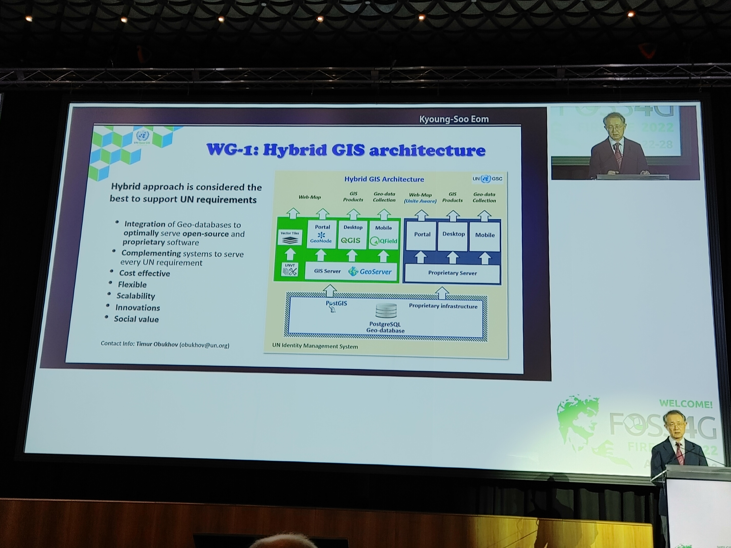
« QField has been spotlighted by the UN OpenGIS initiative as a crucial part of their hybrid GIS system. This recognition underscores QField's superior capabilities in supporting multiple United Nations Sustainable Development Goals (SDGs) and revolutionizing geospatial data collection. »
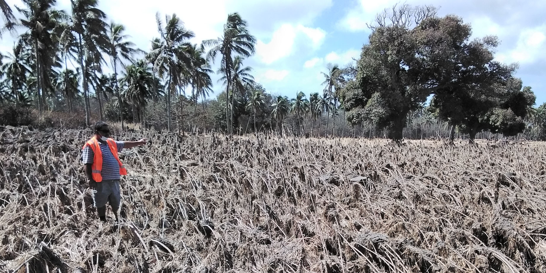
Read more...In January 2022 the Hunga Tonga-Hunga Ha’apai submarine volcano erupted. Ash clouds from the eruption and the subsequent tsunami damaged croplands on the Tongatapu and Ha’apai island groups. The internet cable to Tonga was severed during the eruption. In particular, QField was used to generate maps of where fields had been cleared and re-ploughed using government support.
Read more...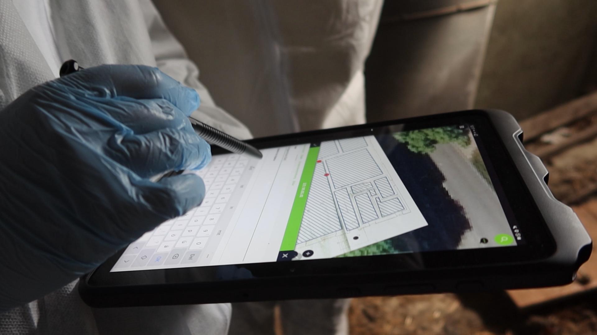


QField and QFieldCloud form the leading professional fieldwork platform used in enterprise settings for efficient geospatial data collection, synchronization, and management. As Digital Public Goods, they not only excel in enterprise and professional applications but also contribute significantly to advancing at least six of the United Nations Sustainable Development Goals (SDGs), promoting a more sustainable and equitable future.
Subscribe to our newsletter and stay up to date on the latest and greatest!
QField is released under the GNU Public License (GPL) Version 2 or above. QFieldCloud is released under the MIT License. Developing our solutions under these licenses means that you can inspect and modify the source code and guarantees that you will always have access to a complete QGIS-based field data collection and synchronization platform that is free of cost and can be freely modified.
View our Legal Information to learn about our privacy policy, terms of service, data processing agreement (DPA), and other legal matters.
QField, QFieldCloud and QFieldSync are developed by OPENGIS.ch. OPENGIS.ch offers consulting, development, training and support for open-source software including QField, QGIS and PostGIS.